New World Scheduler can create and manage congregation Territories and maps, including Territory Boundaries, Territory Information, Territory Addresses, Territory Assignments, Territory Maps and more.
Territory boundaries can be assigned different colors and are used when printing Territory Cards or displaying territories on the NW Publisher app.
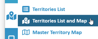
Territories List and Map is exactly the same as Territories List, except with a Map display.
To access the Territories List and Map, click Territories > Territories List and Map
Territories List functions
Territories Map functions
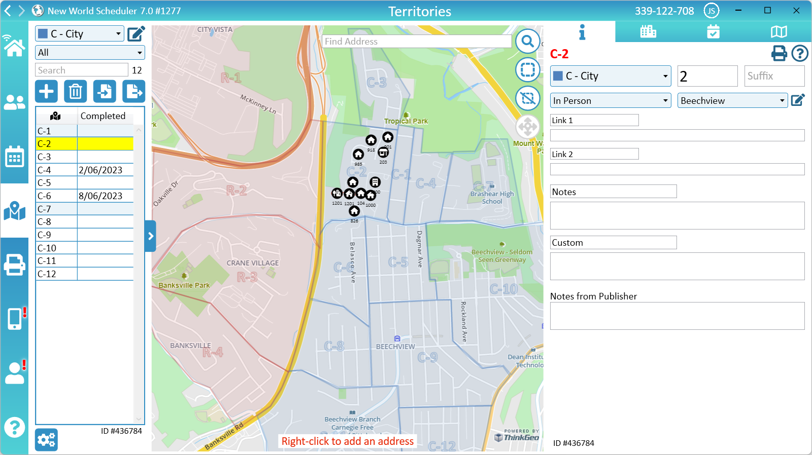
Territory Address Search
You can Search for any Territory Address by typing the address in the Search bar (top of Map view).
Searching will do two things:
- Use the Geocoding provider to search for this address, and then show this location on the map.
- Search your addresses database and select any existing address at the same location.
Searching can also be helpful to check if an address has already been added to your database.
Map of Territories
The Master Map shows an overview of all your territories that have territory boundary.
When a territory is selected, the Master Map will also show all Territory Addresses with coordinates inside that territory.
- To Pan the Master Map, left-click and drag.
- To Zoom the Master Map, use the mouse scroll-wheel.
- To Search the Master Map, click Find Address.
Map Provider
The physical Map Data (e.g. houses, streets) comes from the Map Provider. We currently provide mapping data from the following sources:
- ThinkGeo
- ThinkGeo Dark
- OpenStreetMap
You can change the map provider in Territory Settings or on the map itself, and select the provider that provides the most detail for your area.
The level of detail shown on the maps depends on the provider and the location. There is nothing we can do about this. We do not control map data.
- Note: OpenStreetMap allows users to Edit the global map data. Please visit openstreetmap.org for more information.
Regardless of map provider or map detail, you can add Territory Addresses to all maps. Simply right-click any location to add an Address at that location. This will show a House, Apartment or Business icon at that location and be visible on the map.
Google Maps have the most detail, but are very, very expensive. We cannot add Google Maps at this time.
Adjust Master Map size
The two blue bars on either side of the Master Map can be used to adjust the size of the Master Map, and the left and right columns.
These sizes have limits. If you adjust too far, the will snap back to the original position.
The positions will be remembered for next time.
Close the Master Map
The Master Map can be closed or minimised by clicking the Minimize button (bottom-left corner of Master Map)
Add Territory Boundaries
Import Terrirory Boundaries
Territory Boundaries can be can Imported from either Territory Helper or Google KML.
They can also be created using online tools such as https://kml-splitter.vercel.app/ and then imported in NWS.
Draw Terrirory Boundary
You can quickly and easily draw Territory Boundaries for each Territory in your congregation.
- Select a territory
- Note: Only in-person territories can have a territory boundary
- Pan (by click and drag), scroll (using the mouse scroll wheel) or search (using the Find Address box) the map to find the area where you want to draw your boundary.
- Click the Add or Edit Territory Boundary button (top-right button)
- Left click to draw the territory boundary
- Double-click to finish creating the territory boundary
Edit Territory Boundary
- Select a territory that already has a boundary
- Click the Add or Edit Territory Boundary button (top-right button)
- Left-click to drag any existing point to a new position.
- Double-click an existing point to delete that point.
- Left-click the middle of a line to add a new point.
- Click the Add or Edit Territory Boundary button again to finish editing
Delete Territory Boundary
- Select a territory that already has a boundary
- Click the Delete Territory Boundary button (top-right button)
Import Boundary from KML
- Select a territory
- Click the Import Boundary from KML button (top-right button)
- Select the KML file on your computer
Data Size
The bottom-right corner will display the total Data Size for this territory. The Data Size is made up from all the Territory Information as well as the Territory Boundary.
Addresses, Assignments or Map view screenshots do not affect the data size.
If the Data Size for the selected territory is greater than 3000 bytes, a red Warning will be shown. The most common causes of large data is:
- Too many Territory Notes. Please keep notes brief.
- Too many Territory Boundary points. Please keep territory boundaries simple and don’t add too many points.
- Very long Territory Links
As there is a limit of how much data can be sent to the NW Publisher app, if you have too many large territories Assigned at once, you may receive errors when sending app data.
- Example: 50 Assigned Territories that average 2500 bytes will be fine, but 100 Assigned Territories that average 5000 bytes may cause problems.
Example Boundary
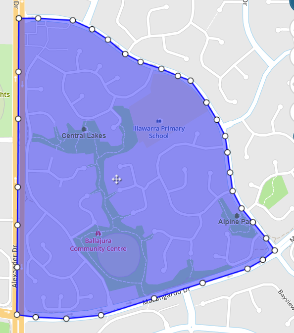
- Incorrect - Too many Boundary points
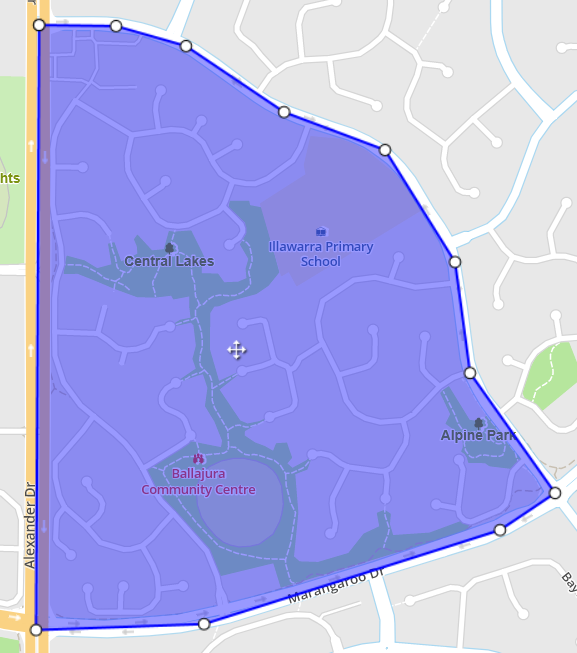
- Correct - Simple Boundary points
Territory Addresses
Territory Addresses can be added to a Territory and display on the map.
They will display both on the printed Territory Card and NW Publisher app.
To add or edit Territory Addresses, please see Territory Addresses.
Move Territory Address
- Select a territory
- Select an address that has already been Geolocated, either on the map or in the Address List
- Click the Move Address button (top-right buttons)
- Move the address to the correct location
- Press OK
Select Addresses
- Select a territory that contains Geolocated addresses
- Click the Select Addresses button (top-right buttons)
- Draw a selection around the addresses you wish to select, double-click to finish drawing
- Those address will now be selected
Territory Labels
Territory Labels are text that can be typed on the map. They could be used for Block Number or any other text you require.
They will display both on the printed Territory Card and NW Publisher app.
Add Territory Label
- Select a territory
- Note: Only in-person territories can have territory labels
- Ensure the territory already has a Boundary
- Click the Add/Remove Territory Labels button (top-right buttons)
- Right-click at the location you wish to draw a label
- Enter the label text
- Press OK
- Click the Add/Remove Territory Labels button again
Remove Territory Label
- Click Territories
- Select a territory
- Note: Only in-person territories can have territory labels
- Click the Add/Remove Territory Labels button (top-right buttons)
- Left-click any label to remove
- Click the Add/Remove Territory Labels button again
Split Territory
There is no way to automatically split a territory into multiple territories, however this is very quick and easy to do.
- Example: You want to split Territory 1 into 1-A and 1-B.
Create New Territory
- Create a new Territory with Number 1 and Suffix B
- Note: Ensure the new Territory is in the same Territory Category as the old territory.
- Draw the new Territory 1-B Boundary. You can use the existing Territory 1 boundary as a guide
Move Addresses
- Select the old Territory Number 1
- Select Addresses to be moved. There are 2 options to Select Addresses:
- OPTION 1: Click the Select Addresses button on the map and draw a shape around the addresses to be moved to the new Territory 1-B, OR
- OPTION 2: On the Territory Addresses tab, select the addresses in the address list that should belong to the new Territory 1-B
- On the Territory Addresses tab, click Move Addresses > select the new Territory 1-B > click OK
Edit Original Territory
- Edit the Territory 1 Boundary to now reflect the new boundary
- Add a suffix A to Territory 1
Merge Territories
There is no way to automatically merge multiple territories, however this is very quick and easy to do.
- Example: You want to merge Territories 1-A and 1-B into Territory 1.
- Select Territory 1-A
- Remove the Suffix “A”
- Edit the Boundary so it now covers both 1-A and 1-B
- Select the Territory 1-B
- Click Addresses and select all addresses
- Click Move Addresses > select the new Territory 1 > click OK
- Delete Territory 1-B
Additional Help
- Territories Help
- Territories List
- Territories List and Map
- Territory Information
- Territory Addresses
- Territory Assignments
- Territory Map (Printed)
- Master Territory Map
- Territory Campaigns
- Territory Settings
- Letter Writing Maps
- Phone Witnessing Maps
- NW Publisher app Features – Territories
- Print Territory Reports and Territory Cards
- Import Territories, Addresses & Territory Assignment Records
- Common Territory Questions and Problems